Thabana Ntlenyana
| Thabana Ntlenyana | |
|---|---|
 | |
| Highest point | |
| Elevation | 3,482 m (11,424 ft) |
| Prominence | 2,392 m (7,848 ft)[1] |
| Isolation | 3,003 km (1,866 mi) to Mount Loolmalasin[2] |
| Listing | Country high point Ultra Ribu |
| Coordinates | 29°28′S 29°16′E / 29.467°S 29.267°E |
| Geography | |
| Location | Lesotho |
| Parent range | Maloti |
| Climbing | |
| Easiest route | Hike |
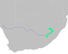
Thabana Ntlenyana (tah-BAH-nə in-TLAY-nyə-nə)[3] is the highest mountain in southern Africa. It stands 3,482 metres (11,424 ft) tall within the lofty Maloti Mountains that crest Lesotho, a small landlocked nation surrounded by South Africa.[4]: 131 The peak's name means "beautiful little mountain" in the Sesotho language,[5] from thaba (mountain), the diminutive -na, and ntlenyana (beautiful).[6]
Geography
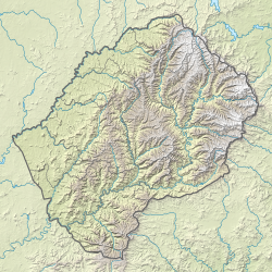
[edit]Thabana Ntlenyana is situated on the Mohlesi ridge, north of the treacherous Sani Pass.[4]: 81 The peak is climbed as part of a "Grand Traverse" of the Maloti, which follows a large system of peaks within the Maloti (Maluti) and the broader Drakensberg.[7] Thabana Ntlenyana, like the broader highlands around it, is made of amygdaloidal flood basalt that formed during the Upper Triassic and Lower Jurassic epochs.[8] Nearby the mountain are the headwaters of the Orange River, which runs approximately 1,300 kilometres (810 mi) to the west before draining into the Atlantic Ocean. Together with its main tributary, the Vaal River, the Orange River's catchment spans around 855,000 square kilometres (330,000 sq mi) of land across Southern Africa.[9]
Ecology
[edit]The high-elevation treeless areas in the Drakensberg like Thabana Ntlenyana are categorized by the World Wide Fund for Nature as part of the Drakensberg alti-montane grasslands and woodlands ecoregion.[10] This ecoregion is characterized by high elevation and high rainfall, but also by cooler temperatures than more equatorial montane areas. Rainfall comes in summer, often exceeding 1,000 millimetres (39 in) per year. Snowfall can occur in winter. Temperature varies from −8 °C (18 °F) to 32 °C (90 °F), with an average of 13 °C (55 °F).[11]

Vegetation in the Maloti is known to vary with the surface geomorphic features beneath it, such as the soil's grain size, carbon content, and depth.[12] Flora communities are composed largely of tussock grasses and ericoid shrubs. Some of the most prevalent grass, sedge, and ericoid species are Merxmuellera disticha, M. drakensbergensis, Poa banana, Carex clavata, and Scirpus falsus.[11]
The unique faunal communities of the Drakensberg grasslands have not yet been fully described by the scientific community. However, a 2001 study surveyed avian populations on Thabana Ntlenyana in particular. It found relatively low species diversity (23 spp.), with about a dozen living at the summit and more living in the peak's foothills. The majority of breeding pairs recorded were insectivores, with the remaining mostly being granivores. The most dominant species across Thabana Ntlenyana was the Cape bunting (Emberiza capensis). At the summit, the African stonechat (Saxicola torquata), sickle-winged chat (Cercomela sinuata), and African pipit (Anthus cinnamomeus) dominated, while the lower foothills were home to more of the sentinel rock thrush (Monticola explorator), Drakensberg siskin (Pseudochlor. symonsi), and Drakensberg rockjumper (Chaetops aurant.).[13]
Access
[edit]The peak is often climbed from Sani Top Chalet or from Vergelegen Nature Reserve.[14] The first recorded ascent by Western-tradition mountaineers was achieved in March 1951 by a South African-English team of leader Desmond Watkins, surveyors Barry Anderson and Roy Goodwin, mountaineer C. W. Jorgensen, and least three other assistants, described by Jorgensen only as "cooks, bottlewashers and scarecrows."[15]

Resources
[edit]References
[edit]- ^ "World Ribus – Southern Africa". World Ribus. Retrieved 26 December 2024.
- ^ "Thabana Ntlenyana - Peakbagger.com". www.peakbagger.com. Retrieved 21 April 2024.
- ^ "Thabana-Ntlenyana". CollinsDictionary.com. HarperCollins. Retrieved 30 December 2022.
- ^ a b Coulson, David; Clarke, James (1983). Mountain odyssey in Southern Africa. Internet Archive. Macmillan South Africa. ISBN 978-0-86954-137-1.
- ^ Sommer, Chris. "Roof of the Maloti".
- ^ Everett-Heath, John (2020). "Thabana Ntlenyana". Concise Oxford Dictionary of World Place Names. doi:10.1093/acref/9780191905636.001.0001. ISBN 978-0-19-190563-6.
- ^ Sommer, Chris (8 October 2007). "Grand Traverse". Vertical-Endeavor.com. Retrieved 30 December 2022.
- ^ Sumner, P.D. (October 2004). "Geomorphic and climatic implications of relict openwork block accumulations near Thabana-Ntlenyana, Lesotho". Geografiska Annaler: Series A, Physical Geography. 86 (3): 289–302. Bibcode:2004GeAnA..86..289S. doi:10.1111/j.0435-3676.2004.00232.x. Retrieved 21 April 2024.
- ^ Cooks, Johann; Wellington, John H.; Hattingh, Phillip S.; Setia, Veenu (17 March 2024). "Orange River". www.britannica.com. Encyclopedia Britannica. Retrieved 21 April 2024.
- ^ Olson, David M.; Dinerstein, Eric; Wikramanayake, Eric D.; Burgess, Neil D.; Powell, George V. N.; Underwood, Emma C.; D'Amico, Jennifer A.; Itoua, Illanga; Strand, Holly E.; Morrison, John C.; Loucks, Colby J.; Allnutt, Thomas F.; Ricketts, Taylor H.; Kura, Yumiko; Lamoreux, John F.; Wettengel, Wesley W.; Hedao, Prashant; Kassem, Kenneth R. (2001). "Terrestrial Ecoregions of the World: A New Map of Life on Earth". BioScience. 51 (11): 933. doi:10.1641/0006-3568(2001)051[0933:TEOTWA]2.0.CO;2.
- ^ a b Mucina, Ladislav; Rutherford, Michael C. (2006). Vegetation of South Africa. Pretoria: South African National Biodiversity Institute. ISBN 978-1-919976-21-1.
- ^ Knight, Jasper; Grab, Stefan W.; Carbutt, Clinton (3 April 2018). "Influence of mountain geomorphology on alpine ecosystems in the Drakensberg Alpine Centre, Southern Africa". Geografiska Annaler: Series A, Physical Geography. 100 (2): 140–162. Bibcode:2018GeAnA.100..140K. doi:10.1080/04353676.2017.1418628.
- ^ Kopij, G (2010). "Avian assemblages in the area around Thabana Ntlenyana, the highest peak of Southern Africa". Zeszyty Naukowe Uniwersytetu Przyrodniczego we Wrocławiu - Biologia i Hodowla Zwierząt. 60 (577): 67–75. Retrieved 21 April 2024.
- ^ Geo Maps Series Map 5.
- ^ Jorgensen, C. W. (1952). "Thadentsonyana Basutoland, Easter, 1951". Yorkshire Ramblers' Club Journal. 7 (26): 305–310. Retrieved 21 April 2024.

